
The Trail of the Coeur d’Alenes is a 73-mile paved trail spanning the Idaho Panhandle between Mullan and Plummer. It was created through a unique partnership between the Coeur d’Alene Tribe, Union Pacific Railroad, the U.S. Government, and the State of Idaho. Whether you’re a vacation rental owner looking to attract guests or a rider planning your own trip, this trail is one of Idaho’s biggest draws for outdoor recreation, pulling in over 140,000 visits per year.
Key Takeaways
- The entire trail covers 73 miles of smooth, paved asphalt from the Montana border to the Washington border, making it accessible to riders and walkers of every skill level.
- Twenty developed trailheads provide entry points, and there are twenty scenic waysides along the route with tables to stop for a picnic or a short rest.
- The trail passes through historic Silver Valley mining towns, the chain lakes region, and along Lake Coeur d’Alene before crossing the famous Chatcolet Bridge.
- Class 1 and 2 e-bikes are allowed on the trail.
Looking to maximize your vacation rental’s bookings near the trail? NW Hosting helps Idaho property owners attract outdoor adventure seekers with full-service management, dynamic pricing, and local expertise.
What is the Trail of the Coeur d’Alenes?
The Trail of the Coeur d’Alenes is a paved rail trail that follows a former Union Pacific Railroad right-of-way across the width of North Idaho. Originally a railroad line built for the bustling mining industry in the Silver Valley, it was converted to a trail in the year 2000. It opened to the public in 2004.
The trail is managed by the Idaho Department of Parks and Recreation and the Coeur d’Alene Tribe. The Coeur d’Alene Tribe (also spelled Coeur d’Alene Tribe), known as the schitsu’umsh, meaning “Those who were found here” or “The Discovered People,” is proud to welcome trail users to recreate on the trail running through the Tribe’s homeland.
It was named one of the 25 top trails in the nation in 2010 by the Rails to Trails Conservancy. That recognition put the trail on the national map, and visitation has steadily grown since.
Trail Overview: Section by Section
The trail takes riders through diverse landscapes, ecosystems, and towns spanning nearly the entire Idaho Panhandle. Here’s what you’ll find from east to west.
| Trail Section | Distance | Highlights |
| Mullan to Wallace | ~10 miles | The trail begins near the Montana border. Steepest climb on the route. Historic mining town scenery. |
| Wallace to Kellogg | ~8 miles | Historic Wallace, Silver Mountain views, restaurants, and shops. |
| Kellogg to Pinehurst | ~7 miles | Historic Silver Valley towns, mountain mining town character. |
| Pinehurst to Enaville | ~5 miles | South Fork of the Coeur d’Alene River. Forested ride. |
| Enaville to Cataldo | ~6 miles | Coeur d’Alene River views. Snake Pit Restaurant. Peaceful and flat. |
| Cataldo to Medimont | ~16 miles | Chain Lakes region, 15 small lakes, top wildlife viewing. |
| Medimont to Harrison | ~7 miles | Coeur d’Alene Lake shoreline. Harrison Creamery stop. |
| Harrison to Heyburn | ~7 miles | Famous Chatcolet Bridge, Lake Coeur d’Alene, and Heyburn State Park. |
| Heyburn to Plummer | ~7 miles | Palouse prairie, forested Plummer Creek Canyon. Plummer trailhead. |
Pro Tip: The best section of the trail goes from Harrison to Heyburn. This section skirts the banks of Lake Coeur d’Alene, crosses over the famous Chatcolet Bridge, and ends in Idaho’s first state park.
Top Highlights Along the Trail
The Famous Chatcolet Bridge
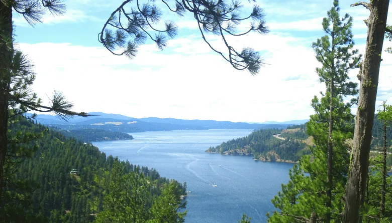
The west end of the trail lies within the interior boundaries of the Coeur d’Alene Indian Reservation and along the shoreline of scenic Coeur d’Alene Lake before crossing the 3,100-foot Chatcolet Bridge/Trestle to Heyburn State Park. This bridge is the single most photographed spot on the entire trail.
The bridge has a stair-step ramp to ease the uphill climb and makes for an exhilarating ride downhill, rollercoaster-like. It’s a must-ride for every visitor, and the breathtaking scenery of the lake from the bridge is hard to beat.
The Chain Lakes Region
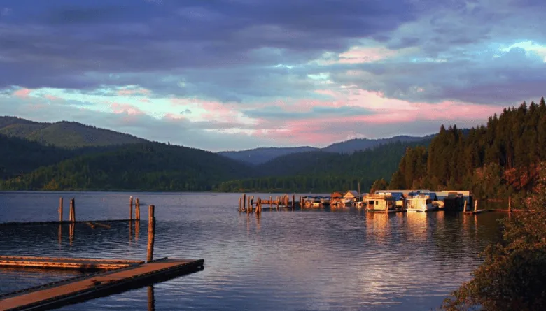
Between Harrison and Medimont, the trail passes through Idaho’s chain-of-lakes region, 15 small lakes and marshes linked by the river. This section offers some of the most peaceful riding on the entire trail, with water on both sides and wildlife around every curve.
Idaho’s Silver Valley
From Medimont east, the trail travels into Idaho’s Silver Valley, once one of the most productive silver-mining areas in the country. The east end passes through a narrow mountain valley dotted with numerous small historic mining communities. Further east, the trail reaches historic Wallace, jam-packed with restaurants and attractions, including the self-proclaimed Center of the Universe.
Heyburn State Park
At Heyburn State Park, trail users can stop for a refreshing swim. Heyburn is Idaho’s first state park and the oldest state park in the Pacific Northwest. The park covers 8,000 acres and is open year-round. This is a great rest stop and campground location for multi-day riders.
Trailheads and Access Points
The trail has 20 developed trail heads from east to west. Here are the key ones to know:
| Trailhead | Location | What’s Nearby |
| Mullan Trailhead | 115 Second St., Mullan | Eastern trailhead near the Montana border. Highest elevation point (3,280 ft). |
| Historic Wallace | Under I-90, 300 feet north of Pine St. and 6th St. | Restaurants, museums, shops. |
| Enaville | Coeur d’Alene River Road | Snake Pit Restaurant, river access. |
| Cataldo | 40052 Riverview Rd. | Near Cataldo Mission State Park. |
| Harrison | Town center | Lake Coeur d’Alene access, Harrison Creamery, Cycle Haus. |
| Plummer Trailhead | Western trailhead | Built and managed by the Coeur d’Alene Tribe. Large, clean trailhead with picnic shelters, restrooms, plenty of parking, and a stunning war memorial. |
Pro Tip: The closest major airport is Spokane International Airport in Washington State, about 50 miles from the Plummer Trailhead on the west end of the trail. This makes it very convenient for out-of-state guests staying at vacation rentals in the Coeur d’Alene area.
Wildlife and Nature on the Trail
One of the biggest surprises for trail users is just how much wildlife you can spot, especially in the chain lakes region and along the Coeur d’Alene River.
Keep an eye out for coyotes, foxes, otters, beavers, river otters, turtles, muskrats, white-tailed deer, elk, moose, and even black bears. Birders will also have opportunities to see great blue herons, western pelicans, eagles, osprey, and other wildlife and birds of prey.
Moose sightings are common along the river sections, especially in the early morning. Keep a safe distance and have your camera ready.
Where to Eat and Stop Along the Trail
You don’t have to pack every meal. There are several great spots right along the route.
Harrison Creamery and Fudge Factory
Harrison Creamery and Fudge Factory is a family-owned ice cream shop located in Harrison, Idaho, along scenic Lake Coeur d’Alene. The shop offers a variety of locally sourced ice cream flavors, including unique options like Huckleberry Heaven and Salted Caramel. It’s the perfect mid-ride reward, especially for families.
The Snake Pit Restaurant
The Snake Pit, at the North Fork of the Coeur d’Alene River, was built in 1880 and is Idaho’s oldest restaurant. Located at the Enaville trailhead, it’s famous for BBQ, burgers, and its eclectic decor filled with over a century of memorabilia. The location has transformed from a mining bar to a recreational hub as the popularity of the Trail of the Coeur d’Alenes has grown traffic through the area.
The Cycle Haus (Harrison)
The Cycle Haus is a bike shop and restaurant just off the trail in Harrison. They offer bike rentals (including e-bikes), food, craft brews, and a shuttle service for riders who want a one-way ride.
Pro Tip: Plan your ride so you finish in Harrison. Between the Cycle Haus, the Harrison Creamery, and the beach on Lake Coeur d’Alene, it’s the best town to end a great ride.
Planning Your Ride
Best Time to Ride
The best times to visit this trail are March through October. Summer (June through August) brings the warmest weather and the most trail users, while spring and fall offer cooler temps and fewer crowds.
What to Bring
- Water: Potable water is not available throughout much of the trail or at trailheads. Bike-friendly businesses along the way will happily refill your water bottles. Bring plenty, especially for longer stretches.
- Sunscreen and layers: Weather in the Idaho Panhandle can shift quickly.
- Snacks: Rest areas with picnic tables are plentiful, but food options are limited to the towns along the route.
- A camera: You’ll want one for the Chatcolet Bridge, the chain lakes, and every moose you spot.
Trail Rules
- The speed limit on the trail is 15 MPH.
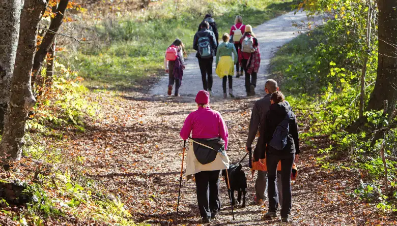
- The trail is a multi-use trail open to walkers, cyclists, e-bikers, in-line skaters, electric wheelchairs, Nordic skiers, and snowshoers. Class 1 and Class 2 e-bikes are allowed on the trail.
- Pets are welcome on a 6-foot leash.
- Stay on the paved trail and in designated picnic areas at all times.
New for 2026: Trail Campground
The Idaho Department of Parks and Recreation, in partnership with the Idaho Department of Environmental Quality, announced the construction of a new 26-site, tent-only campground along the Trail of the Coeur d’Alenes. Designed to meet the growing demand for overnight accommodation along the 73-mile trail, the new campground will provide a comfortable and convenient stopping point for bike packers, touring cyclists, and outdoor enthusiasts.
This is a game-changer for multi-day riders and a huge draw for vacation rental guests who want to combine a trail adventure with comfortable lodging.
Why the Trail of the Coeur d’Alenes Matters for Vacation Rental Owners
The trail drives serious tourism traffic to North Idaho. Although the northern Idaho town of Harrison has just 270 residents, in the summer, the number of people in town swells. Nestled along the eastern shore of Lake Coeur d’Alene and the western tail of the Trail of the Coeur d’Alenes, visitors are drawn in by the outdoor activities that abound here.
That means vacation rentals near the trail, especially in Coeur d’Alene, Harrison, Wallace, and Kellogg, are perfectly positioned to capture this demand. If you own a property in the Idaho Panhandle and want to maximize your bookings, NW Hosting can help you market to trail riders and outdoor recreation enthusiasts year-round.
Frequently Asked Questions
Is the Trail of the Coeur d’Alenes good for mountain biking?
No, this is not a mountain biking trail. The Trail of the Coeur d’Alenes is a fully paved, smooth asphalt rail trail. The trail runs for 73 miles on smooth asphalt that is perfect for cyclists, in-line skaters, walkers, those in wheelchairs, Nordic skiers and snowshoers, birders and wildlife enthusiasts. If you’re looking for mountain biking, Silver Mountain in Kellogg offers lift-served downhill trails nearby.
What are the current trail conditions?
Trail conditions are generally excellent year-round since the entire trail is paved. You don’t have to be fit to enjoy this trail with its gentle grade and smooth surface. For real-time trail conditions, check the Idaho Department of Parks and Recreation website or the Friends of the Coeur d’Alene Trails for any closures or construction updates.
Can I use the trail in winter? Is it open to Nordic skiers?
Yes. The trail is open year-round and is perfect for Nordic skiers and snowshoers. Winter conditions will vary by section. The flatter middle sections along the Coeur d’Alene River tend to be most accessible during colder months.
Are e bikes allowed on the Trail of the Coeur d’Alenes?
Yes, Class 1 and Class 2 e bikes are allowed. The speed limit on the trail is 15 MPH. E bikes are a great option for covering more of the trail in a single day, especially if you want to ride the entire trail from the Mullan trailhead to the Plummer trailhead.
Is there a shuttle service available?
Yes. The Cycle Haus in Harrison operates a shuttle service with regular service on Tuesday, Thursday, Saturday, and Sunday during the season. This is a popular option for riders who want a one-way ride on the beautiful trail without arranging two vehicles.
What skill level do I need for this trail?
Beginner-friendly. The trail has a 1,200 ft elevation change, most of which is on the most easterly and westerly ends of the trail. The vast majority of the route is very flat, making it suitable for families, casual riders, and experienced cyclists alike. If you ride east to west (Mullan to Plummer), you’ll enjoy a mostly downhill route.
Where does the trail begin and end?
The trail spans nearly the entire width of the Idaho Panhandle, stretching from the mountain mining town of Mullan near the Montana border to the rolling Palouse prairie town of Plummer near the Washington border. You can start from either end or from any of the 20 trail heads in between.
Is the Chatcolet Bridge worth the ride?
Absolutely. The Chatcolet Bridge is a 3,100-foot structure that carries trail users across the southern end of Lake Coeur d’Alene. It is the most popular attraction on the Trail of the Coeur d’Alenes. Even if you only have time for one short section, the Harrison to Heyburn State Park ride that crosses the famous Chatcolet Bridge is the one to do.